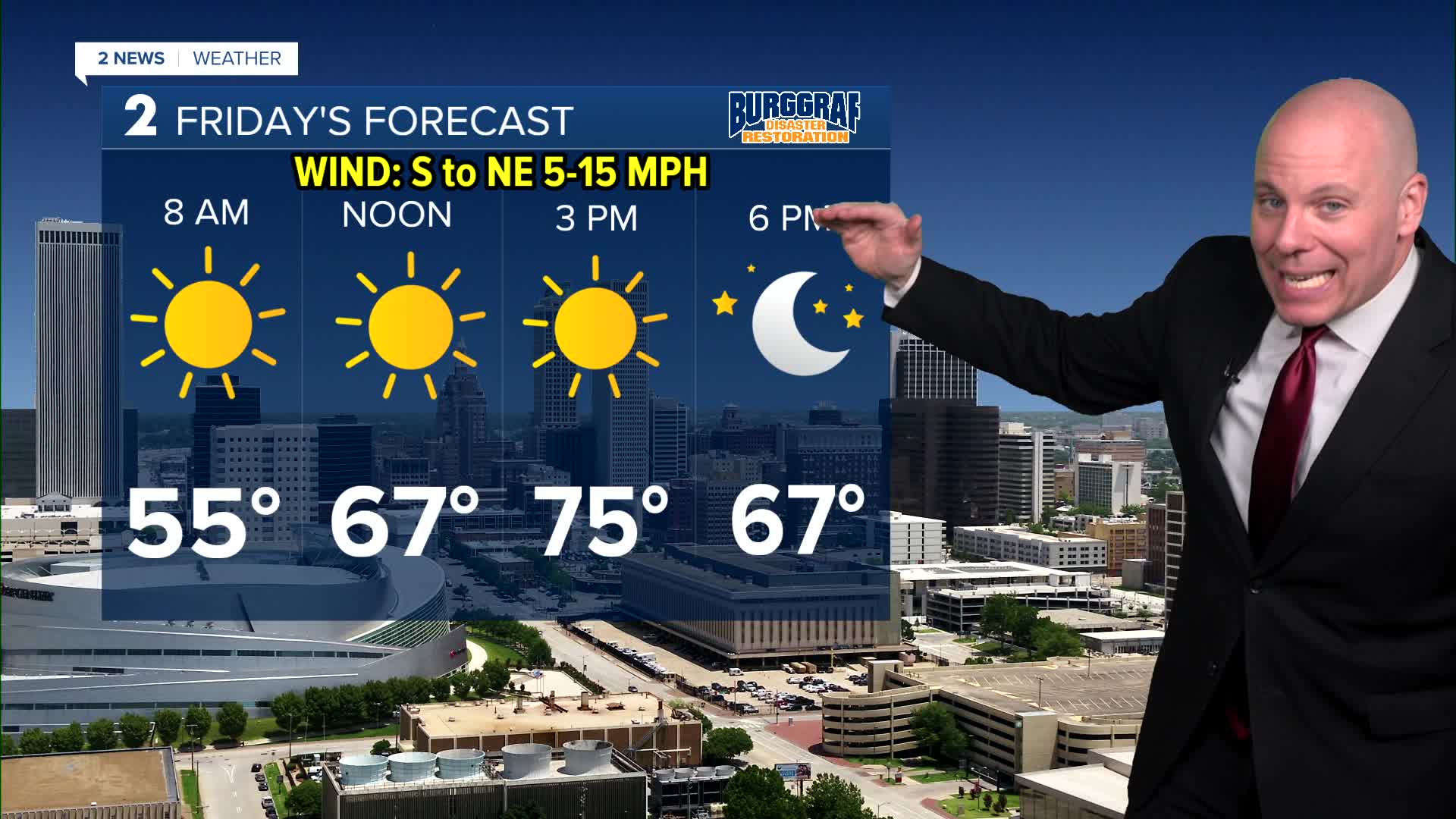


TULSA, Okla. — A weak front drifts south Friday knocking temps down a few degrees for some of us, mostly along and north of HWY 412. Areas near the OK/KS line may get stuck near 70°, we'll be closer to mid 70s in Tulsa. Areas south will still see highs in the upper 70s to near 80°. Friday's record high is 76° from 2008 and we'll be very close to matching that record, but not a guarantee.
Our current forecast still has highs reaching the upper 70s to perhaps low 80s Saturday afternoon with some sunshine mixed with clouds. Saturday's record high is 77° set in 1946 looks be in jeopardy. We potentially could see our 3rd 80-degree day in the last few days. The all-time December record for Tulsa is 80°F, so if we go above that, we could break the record outright.
A strong cold front will sweep through Sunday. Don't get caught by surprise. Despite waking up with temps in the 60s with midday temps in the 70s, we'll eventually fall into the upper 40s late Sunday afternoon with a gusty north breeze. A few showers may be possible as well. Depending on the timing of the cold air and the precipitation, there may be a small window for a light mix north as temperatures keep dropping. Just something we are watching now, still too early to set in stone.
We'll start next week cold finally feeling like this time of year. Mostly sunny Monday and Tuesday with lows down to the 20s and highs in the upper 30s Monday and upper 40s Tuesday. A reminder of what time of year it is.
Have a great and safe Friday and weekend!
Stay in touch with us anytime, anywhere --
- Download our free app for Apple, Android and Kindle devices.
- Sign up for daily newsletters emailed to you
- Like us on Facebook
- Follow us on Instagram
- Watch LIVE 24/7 on YouTube
