

The latest long-term forecasts watching for El Niño and La Niña are pointing to a 50/50 chance of a return to El Niño conditions.
An El Niño is warmer than average water temperatures in the equatorial Pacific Ocean.
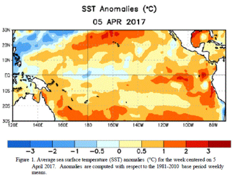
As of March, neutral or average conditions persisted across the central Pacific, but things were beginning to warm up in the eastern Pacific Ocean.
The Climate Prediction Center monitors for the development of an El Niño because it can have an effect on weather across the United States.
For example, the strong El Nino that developed in late 2015 and lasted through 2016 helped to suppress Atlantic tropical storm development in those years, especially in 2015.
RELATED: Storm Shield app can help you track hurricanes
This chance for a return to El Niño conditions in the late summer and early fall has many early hurricane forecasts predicting fewer tropical storms this year because they expect the season to wind down quickly or get cut short all together.
These early signs of any El Niño development are still far off and they're currently pointing to a slightly better than 50 percent chance of a weak El Niño forming in the next four to six months.

So right now, the current forecast is something to take with a grain of salt, but continue to watch in the coming months.
Follow Storm Shield Meteorologist Jason Meyers via the Storm Shield app on Twitter, Facebook, and YouTube. Download the Storm Shield Weather Radio App for your iPhone or Android device and get severe weather alerts wherever you are. Named by Time.com one of the best weather apps for your iPhone.
